Written by guest blogger, Elena Cremonese, Archives Technician
When I first started looking into the archival records on the Cogswell Interchange at the Halifax Municipal Archives, opens a new window, it was to do a bit of research for a social media post, and maybe add some detail to our web exhibit to coincide with the current redesign of the Cogswell Interchange area. But it became quickly apparent that there was just too much material there—we have metres of material from different government departments, Halifax City Council, and citizen’s groups, to condense into a quick post.
The Cogswell Interchange
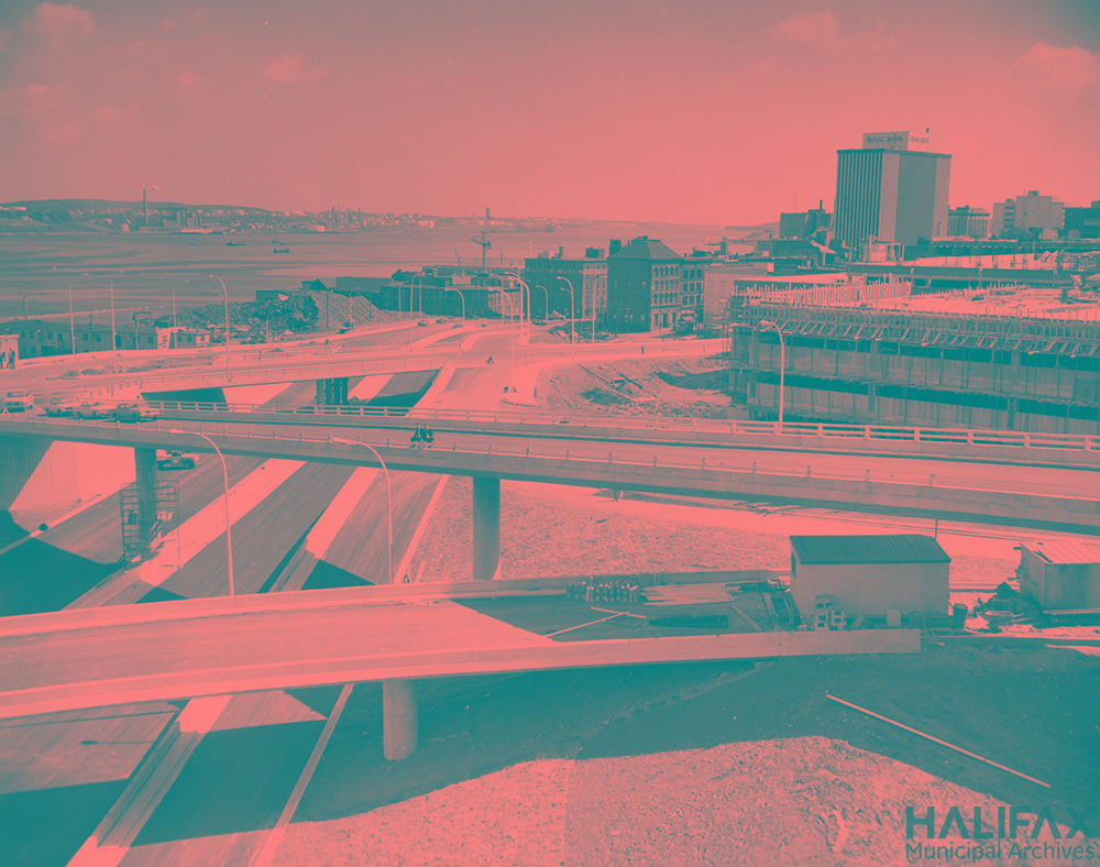
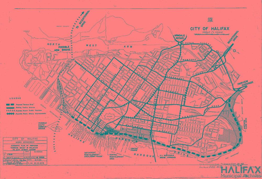
There’s no talking about the Cogswell Interchange in isolation. It was just an initial phase of the ambitious Harbour Drive project, that would have seen a four to six lane freeway beginning at the Fairview Overpass, running along—you guessed it—the Harbour, downtown Halifax, and curling up along Point Pleasant Park to connect with a bridge going over the Northwest Arm. Harbour Drive was part of a broader urban renewal plan that intended to improve traffic flow, invigorate downtown development, and keep pace with Halifax’s suburban growth. It would have connected the MacDonald Bridge to downtown, as well as an anticipated 2nd harbour bridge, proposed to cut across the harbour at the South end of the peninsula, across George’s Island. See the dashed lines on this 1963 plan:
Looking back
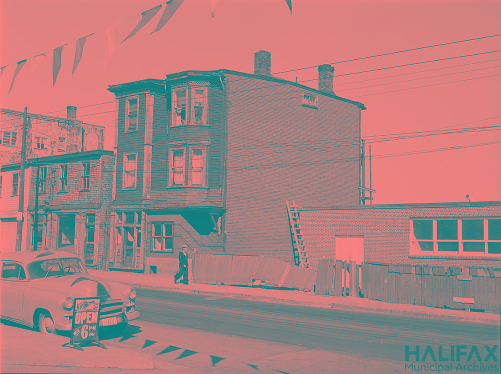
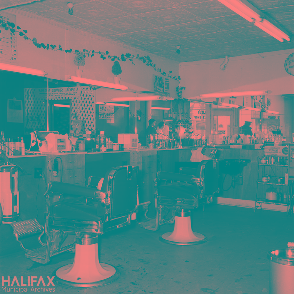
The Cogswell Interchange and the Harbour Drive project were part of a broader trend in urban planning in the mid-20th century. New priorities in urban planning led to slum clearance programs across North America, and the prioritization of cars as the primary mode of transportation (many authors and academics have written about this trend far better than I ever could, and with far more detail). At the Municipal Archives, we have an interesting series of Engineering and Works Department photographs that were taken largely to document dilapidated buildings, particularly those slated for demolition as part of slum clearance and urban renewal programs, such as this one from the Central Redevelopment Area:
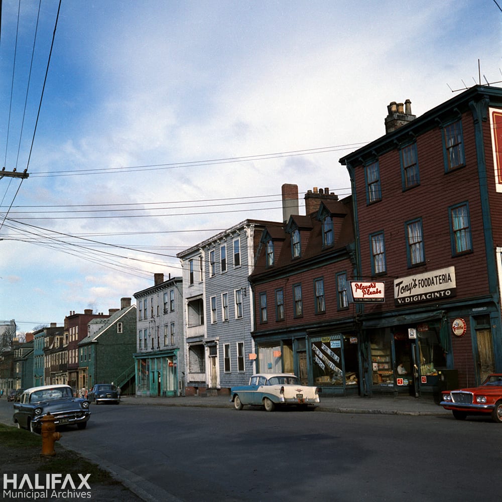
There are several elements of the history of the Cogswell Interchange and Harbour Drive that make it particularly fascinating to me. It is a great window into imagining how the city used to be: Barrington Street, the Cogswell area, and Scotia Square had a completely different feel prior to this project, one that it’s almost hard to conjure up even with the photographs available. And of course, there are those homes and establishments that were never photographed and are just lost to time and people’s fading memories.
This material offers a local perspective of an urban renewal movement that was widespread across North America. It also places Halifax firmly within a broader historical context, and shows the government processes at work in these types of broad policy trends; through the many reports, studies, Council minutes, staff correspondence, policies, and behind-the-scenes decision making.
The Harbour Drive project also serves as a quintessential example of what could have been. It’s hard to imagine a freeway running through downtown Halifax, roughly where Hollis and Lower Water street run today. It’s similarly difficult to picture a bridge over the Northwest Arm, a plan that was only scrapped once the Harbour Drive project fell through in the early 1970s, or a bridge over George’s Island, obscuring the view of the lighthouse and the mouth of the Harbour. How different would downtown Halifax feel to walk or drive through with this freeway?
Public opinion
Equally as important, these records, as well as those at other repositories, show the potential of public engagement and public outcry. The reason we only have a little piece of Harbour Drive today, and one that will soon itself be replaced, is because citizens weren’t happy with the idea of a freeway through downtown Halifax and fought against the destruction of historic waterfront buildings.
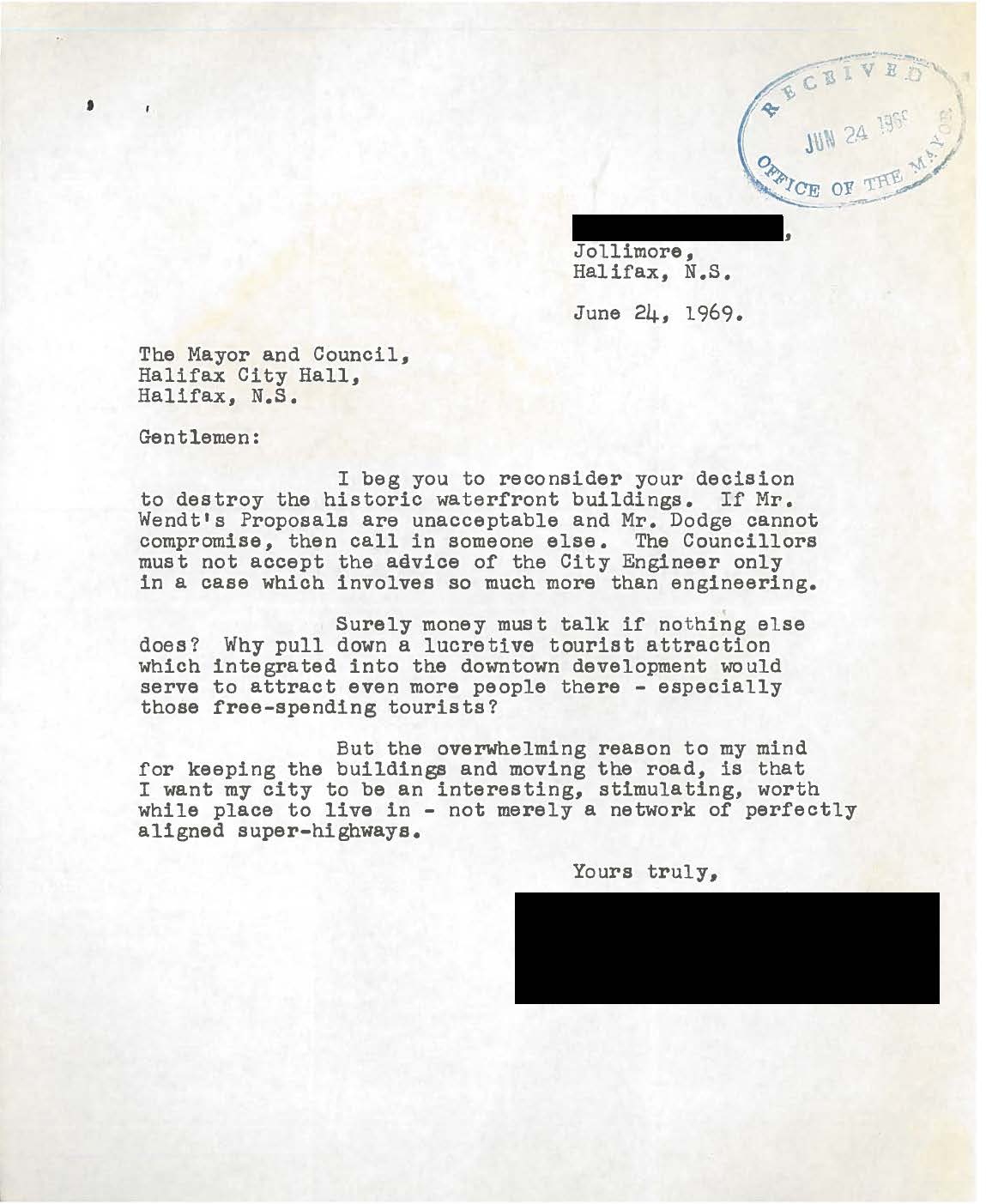
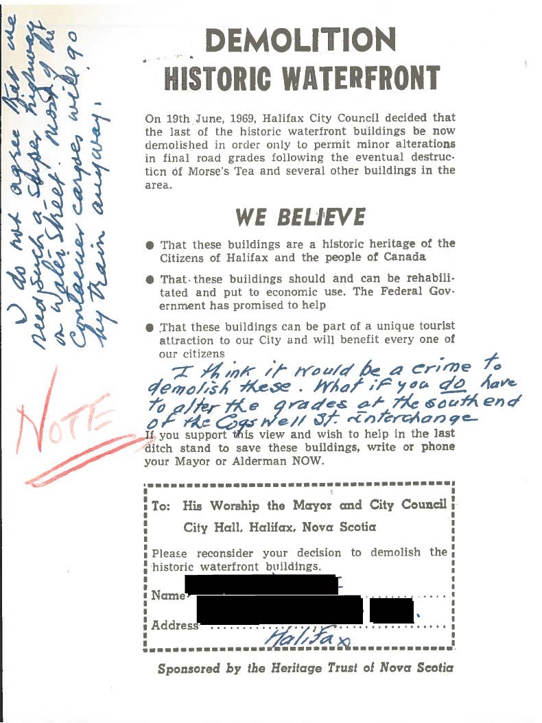
Below is an audio recording from a 1970 CJCH talk show, just before a City Council meeting held to determine the future of the planned Harbour Drive. Host Bill Ozard is against the destruction and takes calls from concerned citizens, tourists, and heritage activist Lou Collins (we have metres of records from Lou Collins too).
Harbour Drive was, for most of the 1960s, a given. The project itself was accepted by the City as the best option to improve traffic and foster development, and the questions that remained were about specifics such as street lines, how many lanes Harbour Drive should be, where to put that second bridge, and where to connect the Northwest Arm Bridge on the mainland side. But ultimately, Harbour Drive was going to happen.
But then, it didn’t. To look at these records today is a real lesson not just in how decisions were made, but how and why they were un-made.
Learn more
You can learn more about the specific records we have available at the Municipal Archives related to the Cogswell Interchange and Harbour Drive by visiting our source guide, opens a new window, and by searching our database, opens a new window.

Add a comment to: Halifax Municipal Archives: The Cogswell Interchange and the Road to Nowhere